Field Explorer
A premium, high-performance web dashboard for detecting and visualizing complex agricultural boundary polygons using satellite imagery.
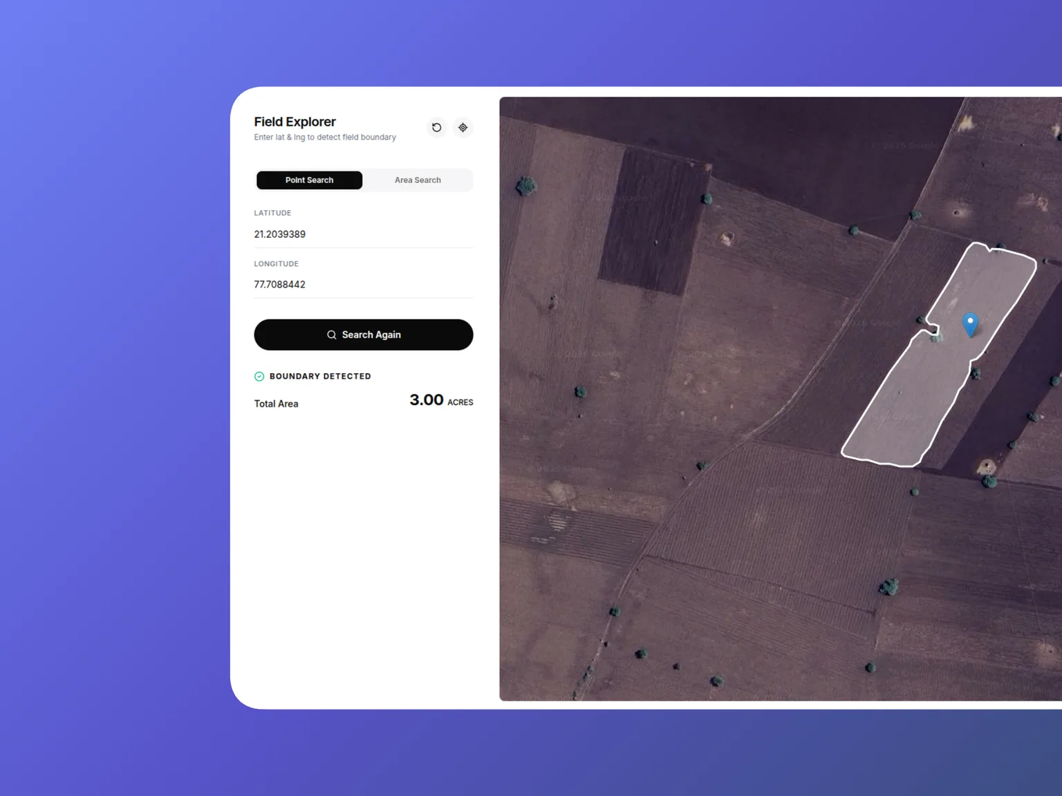
Field Explorer is a sleek, responsive Single Page Application (SPA) designed for rapid geospatial visualization. Built to interface with a third-party satellite field-boundary API, the platform allows users to instantly detect agricultural field boundaries using precision point-searches, GPS geolocation, or dynamic Bounding Box (BBox) area scans. The application features a custom-configured Leaflet map overlaying high-resolution Google Hybrid satellite tiles to ensure maximum visibility in rural regions. Under the hood, it utilizes advanced cursor-based API pagination and geographic math to render hundreds of GeoJSON polygons simultaneously without blocking the main UI thread. The interface is crafted with Tailwind CSS v4, delivering a premium monochrome aesthetic with a seamless dark/light mode architecture and a responsive split-screen layout.
Key Features
- Dual-Mode Geospatial Search: Engineered flexible search algorithms supporting exact Point-based detection and dynamic Area scans (1km to 10km Bounding Boxes) to fetch localized agricultural data.
- Recursive API Pagination: Implemented robust cursor-based pagination logic to successfully fetch, aggregate, and render massive GeoJSON FeatureCollections without dropping data.
- Premium Responsive UI: Architected a split-screen dashboard using Tailwind CSS v4, featuring conditional rendering, smooth CSS-driven micro-interactions, and native dark mode support via CSS variables.
- Optimized Map Rendering: Configured React Leaflet with custom high-resolution satellite tile layers, utilizing
React.memoand dynamic camera flying (flyToBounds) to maintain 60fps performance during heavy polygon updates. - Hardware Integration: Utilized the browser's Geolocation API to instantly center the viewport and fetch boundary data based on the user's real-time physical coordinates.
- Search History & Reset: Tracked prior marker searches in a session history list and added a single unified reset action to clear map state, results, and history together.
- Development Proxying: Configured Vite's local server proxy to seamlessly bypass strict browser CORS policies during local API integration, avoiding hardcoding the upstream API domain into the client.
Key Takeaways
- Mastered the integration of Leaflet within the React rendering lifecycle, specifically handling heavy DOM updates and avoiding redundant map re-renders when UI state changes.
- Deepened expertise in geospatial mathematics, including writing custom algorithms to calculate accurate bounding box coordinates (min/max Lat/Lng) factoring in Earth's curvature.
- Gained hands-on experience with the new Tailwind CSS v4 compiler, utilizing the CSS-first
@themedirective to build a robust, native dark mode system. - Improved data normalization skills by building bulletproof API parsers that gracefully handle varied and deeply nested JSON structures (Arrays vs. FeatureCollections).